by Shirley Tagalik • Photos Courtesy of Aqqiumavvik Society
The Aqqiumavvik Society is a community alliance of public, mental, and community health groups in Arviat, Nunavut. Aqqiumavvik practises a community-identified approach, ensuring that any program or service we develop is based on needs that have been identified by the community itself.
As such, the Aqqiumavvik Ujjiqsuiniq Young Hunters Program was born. The program is meant to teach youth aged 8 to 18 about sustainable harvesting practices. For years, it has also been monitoring decreasing annual precipitation due to climate change. The decrease in snow accumulation in particular contributes to changes in seawater coverage in coastal zones. These rapidly changing conditions and the concerns identified by the community in the Arctic Corridors Research has led Aqqiumavvik to look for solutions to address safer marine travel. How best might we go about mapping coastal waters?
The Arviat community joined the Arctic Corridors Research Project in 2017. The project engaged with 14 northern communities to map and investigate existing shipping routes and their impacts on wildlife, coastlines, and lifestyles, as well as to consider recommended alternative routes for increased shipping around these communities. In Arviat, a group of youth, community researchers, Elders, and experts in land and marine travel participated in the work, which led to a community report. The report outlined a series of recommendations prioritized by the community to address impacts of increased shipping on the community. The primary finding was that accurate marine maps are essential to ensuring safe marine travel. Although approaches to the community were mapped in 1997, no mapping of the coastline has taken place.
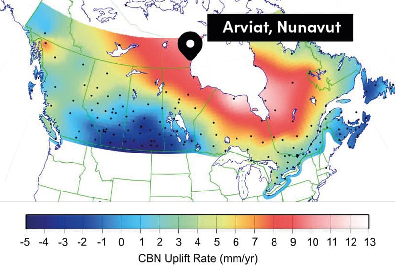
Marine mapping is critical to the Arviat area because Hudson Bay is one of the areas in the world most impacted by isostatic glacial rebound—the lifting up of land depressed by the weight of glaciers. The greater the weight of the glacier, the greater the rebound effect after the glaciers melt.
Glacier ice in Hudson Bay was some of the last to melt. In Arviat, the evidence of post-glacial rebound is evident along the coast, where shoals, reefs, and even small islands are visible today, whereas there was water coverage as little as 10 years ago.
This map shows the rates of lift occurring across Canada. As indicated, the seabed around Arviat is lifting at a rate of about 10 millimetres per year.
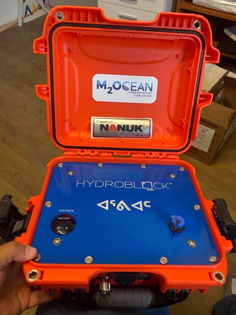
The Canadian Hydrographic Service did not have plans to conduct marine mapping within Arviat since it is not a high shipping area. The Aqqiumavvik Society looked for technology that could enable us to produce our own bathymetric surveys. This led us to the Interdisciplinary Development Centre for Ocean Mapping (CIDCO)—a marine geomatics and hydrospatial research and development organization that develops technologies for marine mapping. CIDCO shared information about a product called HydroBall that we could use in Arviat. They also introduced us to M2Oceans, an organization that was able to provide us with the technology we needed.
In 2019, CIDCO provided us with training to set up and use the HydroBall technology. M2Oceans provided us with the equipment during that survey year. We found that the HydroBall technology was not well suited to our conditions and that we were very limited in the number of days we could survey successfully, since the technology required very calm waters. At the end of the season, we were able to participate in a presentation to a bathymetry and hydrography conference on this work.
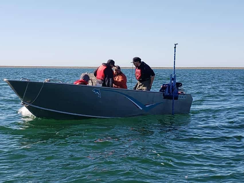
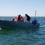
In 2020, we piloted the HydroBlock system, which was much better suited to our conditions and, with training in the technology, we were quite successful in generating accurate maps for our area. We are interested in securing a second HydroBlock so two boats can be in operation over our short boating season, but our attempts to secure funding for this have not yet succeeded. The purchase of and training for the technology requires an outlay of about $30,000. (The data from our 2021 survey was presented at the International Map the Gaps Symposium 2021 Redux.)
Our 2022 mapping season is just opening. We are still operating with just one HydroBlock and boat, but hope to complete the map of our local harbour. We will also try to map the area around Nuvuk (or Eskimo Point), which is where ships currently anchor with supplies for the community. The Government of Nunavut (GN) is relocating the fuel resupply zone to a new area along this coastline but, with no maps or charts available, and with little research on the predictions and impacts of glacial rebound, the community has concerns for the plans currently in place. We hope to be able to provide information to the GN before they commit to this new installation.
It is important to note that it is the community’s youth who are being trained in the use of this technology and in the development of marine maps. Maps are available on our Facebook page and hard copies are available in the community. We are also making them available through SIKU, a mobile app and web platform that provides tools and services for ice safety, language preservation, and weather. It is expected that our youth-made maps will also become available through the Canadian Hydrographic Services website. In the meantime, local hunters are happy to know where they can travel safely in our increasingly changing waters.
Additional Links
- Arctic Corridors Research Project
- Arctic Corridors and Northern Voices Community Report
- Earth Science Stack Exchange Map of Hudson Bay Sea Level Rates
- Interdisciplinary Development Centre for Ocean Mapping
- CIDCO 2021 Colloquium Conference Presentation
- International Map the Gaps Symposium 2021 Redux Presentation
- Aqqiumavvik Society Facebook Page
- SIKU: The Indigenous Social Media App
This article originally appeared in the sixth issue of Root & STEM, Pinnguaq’s free print and online STEAM resource supporting educators in teaching digital skills

